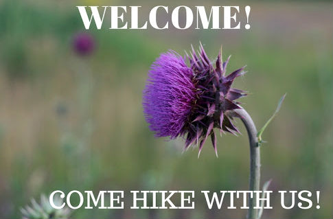
4/21 Kopac - Whaley Ponds Report
Hello Happy Hikers,
Sorry this report is late, but it HAS not been forgotten! 🍃🌿
Not exactly sure of hiked miles, but we had a great group of hikers:
Melissa Twerkowsky, Gwen Welhe, Taylor Zimmer, Jeanne Potter, Guy Fordhan, Don Windsor, Anne Altshuler and myself.
Started out with the sun shining about 34* and ended with a cool brisk wind and gray skies. I estimate close to 3 miles in total of 3 hours. It was leisurely to say the least, stopping to hear Don's wisdom of trees, plants and all other nature like stories. If you know Don than you know what I mean! It was great to have Don hike with us as it sure has been a while since he has graced us with his presence. Which has surely been missed! 😊
The tree we three hugged Gwen has found it to be 13 ft around. Many photos, fun and laughs as you can see was taken. White spruce, marsh marigolds, spring beauties, yellow violets were starting to show their pretty colors. And of course a glimpse of Merganser ducks on Kopac but too far away to take photos.
If you like short and leisurely hikes I might be inclined to lead some more...
Thank you for joining me. 👣
June
Aka SurFootGracie
Hike Report M20 Hoxie Gorge>NY11>NY392
Today four of us carpooled to Hoxie Gorge.
Karen Ellsworth, Gwen Wehbe, Guy Forden, Steve Ellsworth.
It was in the 30's although we were probably over 50 but we are tough.
We headed down the Hoxie Gorge Trail to the culvert where the FLT goes East and West.
This is where Karen and I parted ways. She went East to Stone Rd. and the three of us went West to NY11.
Karen texted at 11:30 and said she was done and had gone out and back 4.5 miles and took her about 2 hours.
We sauntered along exploring, taking photos trying to identify plants and marveled at all the water runs headed to the Tioughnioga R.
There was a round granite rock twice as large as a bowling ball lying in a wash out. I wonder how this happens when all the other stones look like shale or blue stone? Although we did see some other igneous rocks.
We came to a pond filled with weeds then an area with large stones like it was a quarry at sometime.
Guy found a cable that must have been 2" in diameter.
We had looked for a lean-to but realized after checking the waypoint it was a tenting area.
There were several stream crossings and all were successful even with the water so high.
There was 'false mermaid weed' that was growing at the base of several trees.
Skunk cabbage that one of our hikers will attest to the smell.
Round Lobed Hepatica (liverwort)
Long Stalk Sedge that we would have taken for a grass if it were not in bloom.
There were a couple trees torn up that left the bark shredded. Might have been a bear but did not see any claw marks.
A ravenous woodpecker, porcupine???
The most impressive was the amount of wild leeks there.
Walking back on NY11 there was an eagles nest and a DEC sign designating that area as propected.
Hike was:
8.05 mi
- 1,029 ft
Ascent
- 1,260 ft
Descent
Map:
Photos:
The journey is what brings us happiness not the destination (Millman)
Hike Report M20-21 Solon -> Taylor Valley SF (Day Use Area) 04/07/24
What a difference from Friday to Sunday. The sun was out and it wasn't snowing!
4 hikers met just past the Taylor Valley Day Use Area, Ben Howland, Jeanne Peters, Gwen Webhe, Steve Ellsworth
We truckpooled to the Hathaway House in Solon to start the hike with a road walk to the FLT trail in the woods off Telephone Rd.
Once in the woods the trail was easier on the feet and a little wet in some areas.
It was uphill to Mt. Roderick at 1908'.
Just past the summit we came to the trail register next to a cross that is a marker for two people buried there; one, Ruby died in 1877.
Gwen is trying to decipher the faded writing in the wooden cross that someone apparently put there since 1877.
(see the screenshots Gwen found on find-a-grave)
There was an old foundation near there and the 1930 Historic overlay map showed three other houses in the area.
The rest of the trail was downhill haa...
We met another hiker from Syracuse going in the opposite direction. Said he was following an All-Trails loop.
We came to Mt Roderick Rd and followed that to where the FLT made a U-turn that went along Cheningo Creek.
Another register to sign and a Passport Station E03 to get.
The beaver along that section had several dams and we saw a beaver slide, where the beavers slide their building materials and themselves to the water.
There were lots of ramps, spring beauties, Carolina spring beauties, sharp lobed hepatica, daffodils planted long ago but not in bloom, fossils, frog eggs, Myrtle and Coltsfoot along the road.
The hike was 7.25 miles with and ascent of 585' and a descent of 799'
Map:
Photos:
Just tryin' to stay upright,
Steve
Hike Report 4/5/24 M23 Pharsalia WMA Lower Pond -> Jackson Pond
6 hikers showed up at the FLT crossing on NY23, John Nesbitt, Jeanne Peters, Anne Altshuler, Gwen Wehbe, Dennis Geist with Max his companion.
We drove up Elmer Jackson to a blowdown across the road about .5 mile south of the kiosk so we added to the total distance.
On the road walk it started to snow and we were reassured it was not really spring.
The snow on the trees made a tunnel effect down the road.
The water was gushing over the rocks that created the dam laid by the CCC. and we took the obligatory photo from below.
After the kiosk we headed toward the CCC foundations.
We had picked up another hiker, Ben Howland who parked at Center Rd and caught up to our lollygagging pace.
The trail was in pretty good shape and John pulled one blowdown out of the way and we sawed one other.
There were about 5 that needed chainsawing and luckily they were all closer to John Smith Rd.
We crossed John Smith and headed to the Jackson Pond dam past the TRAIL CLOSED sign.
We knew why the trail was closed (logging) but we were not going that far.
A little break and a photo at the dam and it was time to get back into the woods out of the cold wind and snow.
We blindly walked south and found a small cemetery where one of the deceased died in 1829. Others were hard to read.
The walk back to the kiosk was quicker (downhill).
Ben took off on the FLT to the Bullthistle Bridge and then to the Sandberg lean-to.
We turned around and went back to the cars that were left on NY23 then hiked down for a short visit to the Bullthistle Bridge.
A day in the woods is a good day!
Steve
Map:
Photos:
Hike Report FLT M20 Stone Rd->Baker School House SF->Solon
Off to a good start this morning, leaving 2 cars at the Hathaway House on Solon for the end of the trail.
Teri Currie, Jeanne Peters, Christine Gregoire, Gwen Wehbe, Guy Forden & Steve Ellsworth all fit snugly in Guy's truck to ride to the starting point on Stone Rd.
We headed North on Stone Rd to Underwood Hill Rd about 1.25 miles from where we started and turned into the woods to the West and soon found three ponds next to the trail and we thought they might hold fish.
There were ramps just coming up and we saw 'snow drops' flowers that were identified as sharplobed hepatica (liverwort) & mustard garlic.
From the trail we could see McGraw Marathon Road and a farm that had some greenhouses.
What was amazing was they were constructing what looked like 50 more greenhouses.
After crossing the road we headed up and walked along a hedgerow that had a lot of old maples.
One of those maples measured 190" around ~16' with a average diameter of ~60"
We continued up until we got to the Baker School House Rd & SF.
The terrain was up and down but we finally reached the top over 1800'.
Then we descended 450' on switchbacks to the valley.
Originally the hike was planned to hike the DEC truck trail 'horse shoe' back to the Baker SH Rd.
The plan was changed due to a change in the FLT M20 map.
Leaving off the Underwood Hill section but adding on a section down the back side of Baker Schoolhouse SF to Solon.
It was a great idea as we got to see the ruins (foundations) of an old train station but there was on caveat.
Past the train station there was a stream that was flowing pretty good. We walked up and the beavers had damned it and down stream it looked narrower, swifter and deeper.
So, we had to do what was told in a children's book.
'You can't go over it and you can't go under it so you've got to go through it.'
So we waded as quick as we dared and all of our feet got wet.
Luckily this was about the end of the hike and the vehicles were only a short distance.
The hike was 5.9 miles ascent of 686' and a descent of 1022'.
Map:
Photos:
Clean boots,
Steve
More information has surfaced and returned to my memory.
The new M20 map with the description failed to mention that Trout Brook is high at times and crossing may be a challenge in colder weather....
23.1 Enter private land – Bickford Family Trust.
23.8 Cross through the ruins of an old railway station.
23.9 Cross Trout Brook and continue straight (N) on farm road
right-of-way.
The bone Guy found we thought was a deer skull was correctly identified by our resident biologist Gwen as a hip bone.
The Princess pine is a flat branched tree clubmoss.
Be prepared... I remember from Boy Scouts so I think I will put a pair of lightweight water shoes on my MacGyver pack.
Dry Shoes,
Steve

We had a beautiful evening for our out and back hike at Ambler State Forest. It was a winter wonderland up on the hill and the snow-covered tree branches provided some great photos in the setting sun.
After letting the dogs meet and greet and get some excitement out, we set out down the truck trail about 6:53pm. There were 12 hikers and 4 dogs: Teri Currie, Robin VanWagner and dog Jack, Holly Crouch, Melissa Tworkowsky, June Granz, Sharon Pelosi and Scott Sutton with dogs Sully and Grace, Dan Pfeifer, and Rebecca Hargrave, Chris Sprague with James and Sam and dog Apollo.
The truck trail was the road less travelled. No one had driven on the road since the latest snowstorm, so the only tracks were our own and some deer and coyote. We hiked the full length of the truck trail, stopping several time to inspect tracks and take photos of the moon and evening sky. The air was still, there was not a cloud to be seen, and woods were very quiet--though any animal would have had plenty of warning.
We stopped halfway at the turn-around for some photos and to enjoy some gummy worms in honor of March's "Worm" moon. Since several folks asked, here is the meaning behind the worm moon according to almanac.com:
The Surprising Truth Behind the Worm Moon Name
March’s full Moon goes by the name Worm Moon. For many years, we thought this name referred to the earthworms that appear as the soil warms in spring. This invites robins and other birds to feed—a true sign of spring! However, more research revealed another explanation. In the 1760s, Captain Jonathan Carver visited the Naudowessie (Dakota) and other Native American tribes and wrote that the name Worm Moon refers to a different sort of “worm”—beetle larvae—which begin to emerge from the thawing bark of trees and other winter hideouts at this time.
It was dark now for the hike back, but the reflection of the moonlight on the snow was bright enough to cast shadows in the woods and make our headlamps optional. Of particular note, shortly after starting back, a parade of starlink satellites were spotted overhead. There was also a chance that northern lights would be visible, but none were spotted.
After the long trudge up the last hill, we arrived back at the vehicles about 8:50pm, having covered 3.7 miles in 1:58 minutes, and gaining 259ft of total elevation. Photos courtesy of Rebecca.
The next full moon will be April 23rd. Spring sports will be in full swing, so the schedule will be challenging, but watch for a possible hike around the 19th or 20th.
Chris
Hike Report M24 Chestnut Rd - Ludlow Rd O&B 03/24/24
A winter wonderland... thought it was spring?
Five hikers met on Chestnut Rd, Anne Altshuler, Gwen Whebe, Tom Monday, Pat Bonnell & Steve Ellsworth.
At the trailhead going south we sawed enough of a blowdown to get onto the trail.
This was a bending branch hike with the ice and snow glaze on everything.
The snow slowed us down a little but 'steady as she goes' around a few blow downs and side stepping a few wet spots.
The sky cleared to a cold blue and the ice on the branches glimmered in the sun
When we got close to Ludlow Rd. I was reminded that we need to help TCHC put a new register up.
On the return Gwen spotted a fisher crossing in front of us. This was the first this year in the woods on a hike.
A couple weeks ago a fisher crossed as I was driving down Center Rd. to a hike location.
There was a little midden pile of pine bracts on top of the snow over a hole that must be a hiding place.
We normally see these midden piles at the base of a pine tree.
Several blowdowns need attention along this stretch of trail. It will be a busy spring.
It started out in the low 20's and warmed to near 30 when we finished.
We hiked 4.6 miles
Map:
Photos:
Another great day in the woods!
Upright all the way,
Steve
Hike Report M23 Stage Rd - Perkins LT 3/16/24
Another great morning for a hike, I was concerned when I woke up at 4:30 because it was raining but it quit.
Jeanne Peters, Zoe Zerwekh & Dixie), Melissa Tworkowski, Holly Crouch, June Granz & Steve Ellsworth show up at NBT in South Otselic.
From the parking lot we drove to the FLT trailhead on Stage Rd and headed South and uphill.
The recent rain made it soggy and slippery in a few places but nothing stopped us except shortness of breath.
After a couple stream crossings we were paralleling the gorge and in awe of the riffles and waterfalls.
The sound could have been used for a meditation sound byte but walking through it was all we needed for our outdoor fix.
After coming out of the gorge we crossed Clarence Church Rd. and into the pines. The path was soft and level.
It was a welcome change. The register showed that the maintainer (Guy) was the last visitor 3/5 until we entered our group on the next page.
In this section of woods the squirrels had left tremendous midden piles at the bases of some of the pine trees.
Turning off the FLT we headed on the blue spur trail to the lean-to.
After crossing the Johnsen & Wild Plum bridges we made it to the lean-to.
A water break for some and a group photo, green St Patrick's Day cookies, York peppermint patties.
We headed back through the gorge at a much quicker pace back to Stage Rd where we started.
The hike was 4.6 miles and an elevation gain of 660'
Map:
Photos:
On the up and up,
Steve
Hike Report M25 Bear Brook 030924
Seven Hikers headed out to Basswood Rd.
Jeanne Peters, Dot Rice, June Granz, Gwen Wehbe, Anne Altshuler, Melissa Tworkowski, Steve Ellsworth.
We headed down the farm road where the FLT road walk ends and headed to the creek following it up stream.
The water was roaring high and that sound carried us off on our adventure, mesmerized.
Always amazed by the water crashing into the large square edge boulders and then smoothed by the flat bottom of the creek.
The feeder creek was high, hikers helped hikers and everyone made it.
The moss at the bivouac was like fairyland. There were pincushion moss, american climacium and toothed plagiomnium moss.
Hiking to the first falls we heard a splash and then the shadow of a beaver swimming to safety.
We waited a while but didn't see where it surfaced but it showed us with the slap of its tail.
There are a couple videos of the falls and the roar of the creek.
Our group photo was at the second falls upstream.
A 1957 NY Commercial license plate was found (an artifact)
There is a huge white pine on this trail, Anne is standing in front of it.
Dot's raincoat bag tore off her camera bag and didn't notice until the return from the falls.
She went back for a while and looked by her bushwhack around the stream crossing. No luck.
On the return Gwen was able to get some videos of our friend the beaver.
So walking back up the farm road, there was the little red duffle that held the raincoat.
We hiked 3.4 miles and Dot a little more.
This was a perfect hike, timing is everything!
Photos:
Rain Dodger,
Steve
Follow up: Hike Report Hoxie Gorge-Stone Rd O&B 3/3/24
Inquisitive Gwen looked into the Hoxie Gorge metal panel box we saw...
Google lens thought it was a hydroelectric generator, but can’t imagine where electricity would go. The white numbered thing seems to be to measure water depth.
From a geology professor at SUNY Cortland about that mechanism:
This is indeed the defunct USGS-style gauge. It was set-up about 20 years ago to record flow in the creek but it never worked for long. There isn’t enough light in the gorge to sustain the solar power and the recording device was damaged several times by bedload carried by the river. The white board is the depth gauge which was previously in the creek but is now just leaning there, waiting to be returned to my lab.
Good to have smart people on the hike,
Steve
Hike Report M20 Steve Russell Hill Rd to Hoxie Gorge 3/3/20242
from Karen:
On Sunday morning 3/3/2024, Two overachieving hikers, Lisa R and Karen E, headed from Rt.11 at Steve Russell Hill Rd after being dropped off by the Passport Hoxie Hikers with the intention of meeting back up at the Hoxie parking area.
The weather was cloudy though warmer than expected, in the forties and really perfect for a late winter hike.
We headed uphill on the winding dirt road, under the I81 overpass, and alongside one of many creeks along the trail. The trail then turned into the woods and into the Hoxie Gorge State Forest which the trail followed all the way until we reached the SUNY Cortland Hoxie land a half mile from the parking area.
This forest is a beautiful piece of state land that runs along and over several streams and gorges and therefore is a bit hilly. It appears to be not well traveled in the more southern part and a long section of it does not have access points. In several places we could hear the drone of the traffic on I81 which could be annoying but we soon would head into a valley or gorge and feel far removed from the sounds of civilization. There are a few stream crossings that required balance, leaps, luck, and sometimes wet shoes, but we made it across all of them unscathed.
Along the way we noticed some beautifully colored fungi, a couple trees full of gall (Steve told me what these are called), a strange insulator mounted on a heavy metal brace found far from any other markings of civilization (what was it doing there and how old could it be?), one dump which appeared to be in an old stone foundation. Interestingly, there were no stone walls to be seen. This seems unusual in NY to have no walls. As the trail ran by streams and was up and down hills, there seemed to be little sign of previous civilization. It made for a remote feel and a little touched land, at least where the trail ran.
Not until we reached the blue trail on the Cortland land did we encounter other hikers and a more well used trail. The Hoxie Gorge section was beautiful and we enjoyed hiking the blue trail next to the water.
Arriving at the parking lot, we discovered that the Hoxie Passport Hikers still had a ways to go. Fortunately, Karen had the car key and was able to drop Lisa at her car as well as drive to Marathon for a well deserved Pepsi, arriving back to the parking area before the Passport group made it back. Hence the title of 'overachievers'.
total miles 7.3
total elevation gain 1234 feet (elevation difference about 600 feet)
time 3 hours 40 minutes
speed 2.0 miles/hour
Hike Report Hoxie Gorge-Stone Rd O&B 3/3/24
Five hikers met at RT23 and carpooled/caravanned to Marathon.
We picked up Lisa from Fayetteville who was going to hike with Karen up Steve Russell Rd to Hoxie George.
We dropped Karen and Lisa off for their 7 mile uphill hike and planned to meet us after our 5 mile hike at Hoxie Gorge.
5 hikers Jeanne Peters, Guy & Janell Forden, Gwen Wehbe & Steve Ellsworth started out from the Hoxie Gorge Parking lot.
Hoxie Gorge Nature Preserve is part of SUNY Cortland's Environmental Education program.
We started off on the Preserve trail and at the old stone culvert came to the FLT and hiked toward the lean-to.
Next we came to the the passport station / trail register which was not too far out on the trail.
Rubbings were seized and an entry made.
At the lean-to a beautiful creek not 50 feet was wanting us to stay longer.
The burnt floor that was the result of someone starting a fire in the lean-to, repaired.
Those individuals were apparently trying out for the Darwin Award.
A register entry was made and a laugh was conjured up at a previous register entry.
A water break and snack was what we needed.
A little uphill to the top of the hill by the picnic table.
Then a short drop to Stone Rd. (our destination) then we returned.
There were a couple stream crossings, some slippery trail sections but nothing that kept us from making forward progress.
We took the blue trail the whole way back and came out just West of the cars.
Karen and Lisa returned to the cars when we were still 2 miles out.
They went seven and we were at four (over achievers)
The return, we took the blue trail to the road just below the parking lot.
The hike was 5.5 miles with an elevation gain of 667'
Map:
Photos:
Fair weather,
Steve
Hike Report Bullthistle Bridge to CCC Lower Pond O&B 3/1/24
This first day of March, 3 hikers Jeanne Peters, Guy Forden & Steve Ellsworth met for a nice hike on this windless morning compared to the past couple of days.
Over the bank to the Canasawacta Creek to the famously unknown Bullthistle Bridge.
We signed in and the temperature was 26 degrees on the bridge thermometer.
We headed up a couple hills to where the trail leveled off.
The saturated ground was partially frozen which was a blessing as there was not much mud.
There is an old 'logging' road at the top that heads East toward Elmer Jackson Rd.
This road passes a big beaver pond that we decided to investigate on the way back.
Crossing Elmer Jackson and back onto the FLT in the woods following the border of the Pharsalia WMA (Wildlife Management Area)
We met Elmer Jackson again and followed it to the CCC built Lower Pond.
Elmer Jackson had been snow covered, snowmobiled, 4 wheeled on and when the recent rain hit it turned to ice so we were careful of our footing.
There was a blowdown across the road that we didn't want to attempt with our bow saws... it might be the town's responsibility.
The trail was in good shape, not anything that we couldn't move out of the way. Of course Pete and Coleen were there 2/8 and we had hiked it 1/27.
At water break, photos and mangoes (in the summertime) were all part of our halfway point at Lower Pond
The trip back was mostly downhill and we did a little bushwhack to the beaver pond and took a photo of the Lodge then cut diagonally back to the trail near a camp that is across from a trail that leads to the beaver pond, so we had to go there too.
There are plans to bushwhack around that beaver pond sometime in the future .
It was downhill to the Bullthistle Bridge and we made good time with gravity on our side.
The return temperature was 36 degrees in the shade.
Map:
Photos:
Fair weather,
Steve
Hike Report Sunday 2/25/24 Fred Stewart & Center Rd to Sandberg Lean-To O&B
On my way to meet Anne at the Berry Hill fire tower there was Sasquatch standing on the corner of Preston Rd.
(photo)
There were 12 hikers on this cool sunny morning. Anne Altshuler, June Granz, Jeanne Peters, Holly Crouch, Melissa Tworkowski, Gwen Wehbe, Pat Bonnell, Tom Monday, Jenny Mateer, Corinna Ridgeway, Guy Forden, Steve Ellsworth
We met on the South side of Fred Stewart Rd. just off Center Rd. and walked a short distance to the trailhead.
It was 6 degrees when I woke up but it had doubled by the time we took off, the snow was still crusty.
Amazing that the mosses stay so green even at those temperatures.
There were almost fields of fan club moss and shining club moss poking through the snow.
We hiked through the tornado blowdown area that occurred 4/28/11 to the Sidote bench.
Signed in at the trail register and Passport station where some of the hikers got a rubbing that will become a very cool embroidered patch as an award for completing the Passport stations.
Up we walked to the Sandberg lean-to. This has to be the best in the country! All the comforts of home.
Rocker table with Easter candy in a jar. Decorated for Easter and even a wee bit of green for St. Patrick.
One of the Larry hiking sticks #IV was hung on the side of the lean-to
A great place to take a break, drink and snack. Holly provided some fruit bars for all of us.
The return was a little quicker as there was more downhill than the hike in.
By the time we got back it was in the upper 20's
The hike was 3.9 miles with an elevation gain of 205'
Map:
Photos:
Everytime we discover something new,
Steve
Hike Report M22 Stage Rd - Raider Hill Rd O&B 02/22/24
There were three hikers this morning at the Bullthistle Bridge crossing.
Jeanne Peters, Guy Forden, Steve Ellsworth. We carpooled to the trailhead on Stage Rd.
It was sprinkling so we put our rain jackets on and set out down the bank to cross the creek.
The little bridge is gone and must have been washed out?
Guy and Jean found a way to get by the ice and stepped on some stones.
Steve thought he found a way across the ice but found out quickly that it couldn't hold the weight.
Oops.. just a little damp so he crossed on some rocks as well.
The trail went up for quite a ways it seemed and leveled and went up again.
We decided not to wear the microspikes and for the most part we didn't need them.
Lots of deer tracks and some grouse tracks.
Guy spotted one of Larry's hiking sticks at the side of Will Warner Rd by the ladder.
We looked at the Winston Braxton bench dedicated in 1987 for work on the FLT
The snow was too damp to sit a minute.
The rain had softened the snow which probably slowed us down some.
Most of the trail was snow covered and varied from 2" to 6 or more where it drifted in the quarry.
We took a break at Raider Hill Rd. and headed back.
It was interesting that our tracks through the snow brought out the snow fleas.
I tried to get photos of them but couldn't get them to smile.
As usual we did some trail maintenance of branches and removed a few small blowdowns with the saw.
There are about 6 trees that we have coordinates for so we can return with the chainsaw.
The hike was 4.7 miles with an elevation gain of 659'
Photos:
No Bushwhack,
Steve


.JPG)